
Mount Dana,
Attempt 1
June 10, 2018
Mount Dana is a California backcountry skiing rite of passage. The couloirs are steep (but not too steep) and sketchy (but not too sketchy). With a short lead in from Tioga Road on the eastern side of Yosemite National Park, one would assume it would be a relatively straightforward climb. That is what we thought! One thing led to another, and unfortunately the mission was not a success. Some very important lessons were learned. We still had fun, and no one got hurt - in the end, that is a win.
Activity: Backcountry Touring/Mountaineering
Location: Yosemite National Park, CA
Peak Elevation: 12,300ft (short of target)
Elevation Gain: 2,300ft (short of target)
Distance: 5 miles (short of target)
Time: 12 hours
Success/Failure: Failure
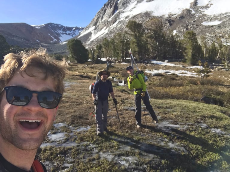
Team: Tim Murcko (Chunkin'), Ronen Sarig (Old Man Winter), Daniel Pare (Ski Patrol Danny Boy)
Postmortem
June 9, 10:06PM: We decided to drive up Saturday evening for a Sunday climb to avoid the usual Friday traffic. We arrived to the eastern side of Yosemite National Park in the dark, setup sleeping arrangements, and crashed. The plan was to get a solid sleep and wake up by 6AM. It was a super short lead in (just a few miles) so how hard could that be?
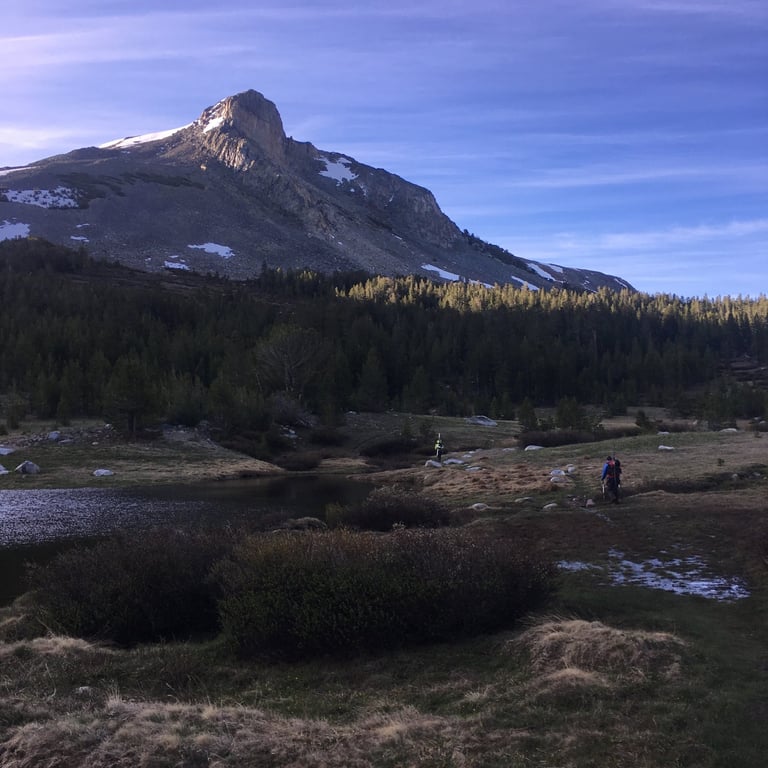
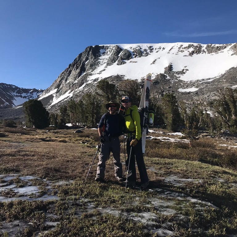
June 10, 6:57AM: We were in motion through the meadow before 7AM. There was no snow at this lower elevation of ~10,000ft so we were walking in trail runners or snowboarding boots. It was a warm morning and layers were quickly shed as the sun rose. Living in the Bay Area and trying to plan these Spring/Summer Alpine tours can be tricky. You never really know what to expect. Avalanche Centers shut down for the season and there is very little posted online. Sometimes AllTrails or various climbing forums have some recent data but that is about it. You need to be prepared for a range of terrain including snow, ice, stream crossings, loose rock fields and scrambling. It was too early to know what the conditions on Mount Dana would actually be.
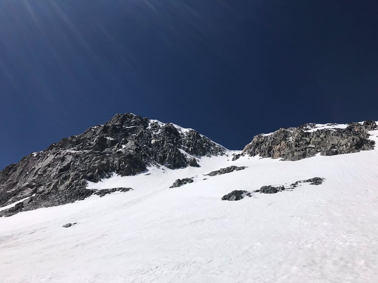
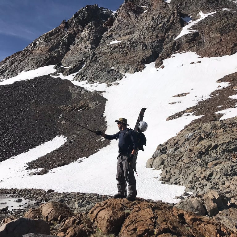
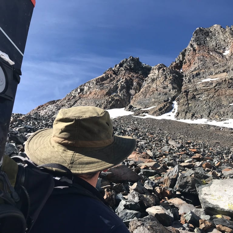
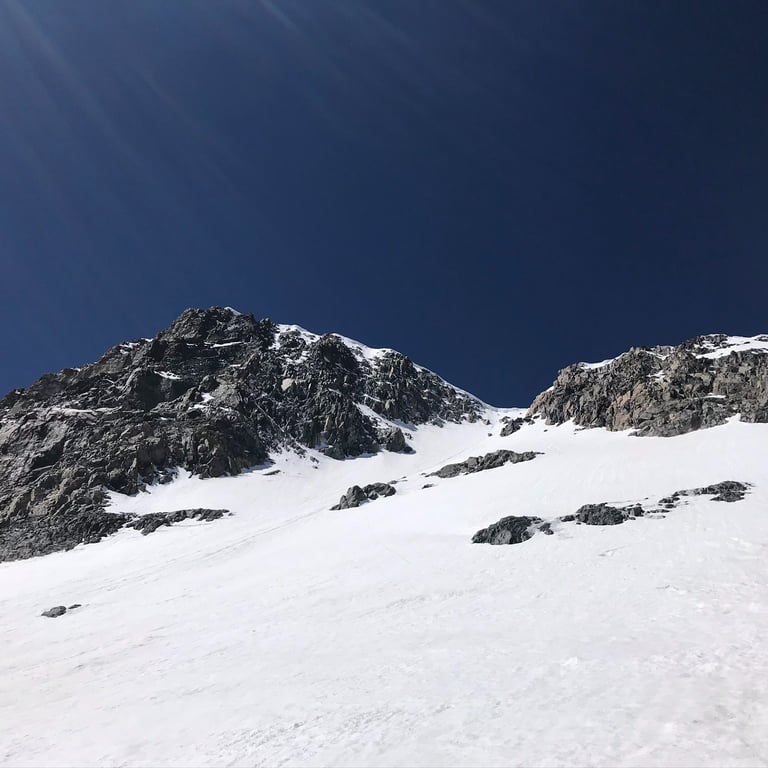
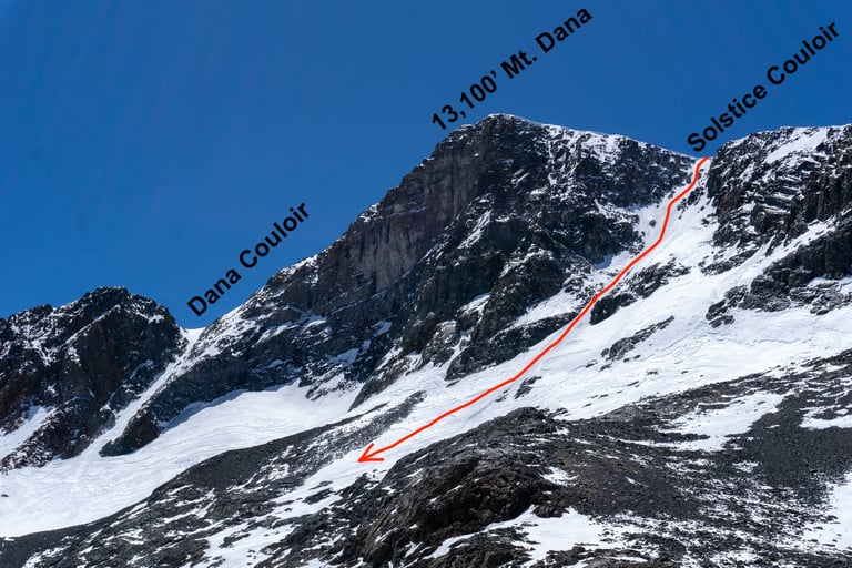
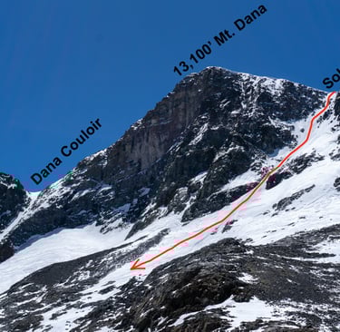
June 10, 10:17AM: As we approached the base of Mount Dana we were already way behind schedule. Our original plan was to hit the Dana Couloir but the lead in was much slower than we had anticipated due to the loose, rocky terrain. Scrambling over rocks is always a bit slow and doing so in snowboarding boots with a board on your back does not help. It was hot and the high elevation was getting to all of us coming from sea level the day before. We made the choice to attempt the Solstice Couloir instead of the Dana Couloir due to the closer proximity. They are roughly the same steepness and vertical but Solstice is more technical due to the rocks and a frequently forming cornice at top.
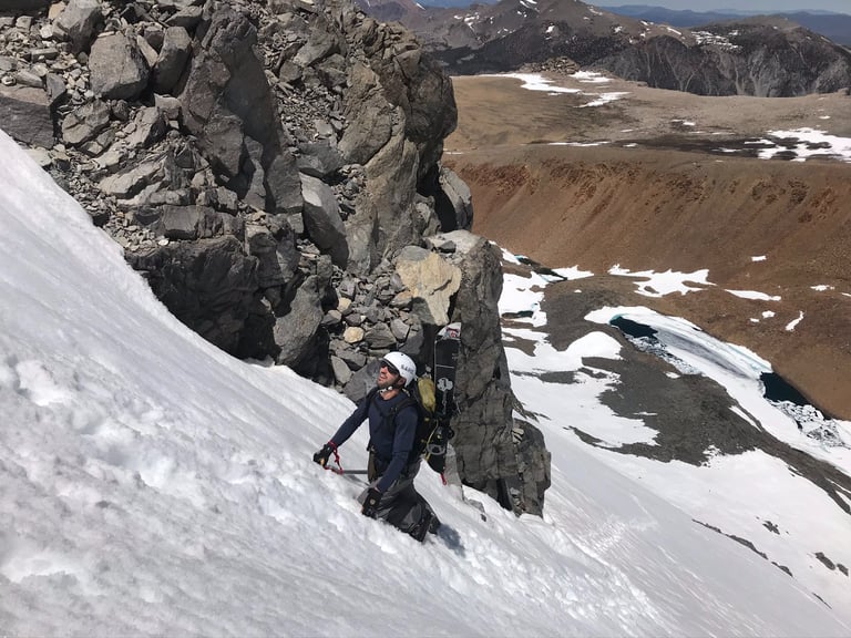
June 10, 1:12PM: We were deep into the couloir at this point. This was the steepest terrain I had ever attempted. Full ice axe, crampons, hands and knees kind of climbing. Progress was slow as I took my time to avoid slipping. I could feel the time pressure as the snow softened up. I felt physically secure while climbing but it was not something I wanted to mess around with. Anxiety drew over me as we climbed up further. This was definitely above my pay grade at the time.
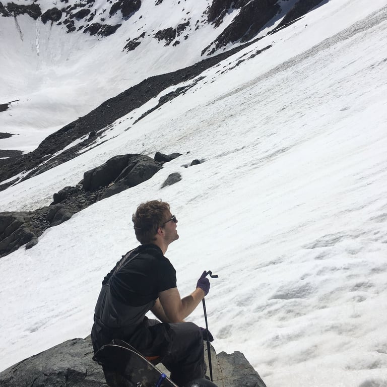
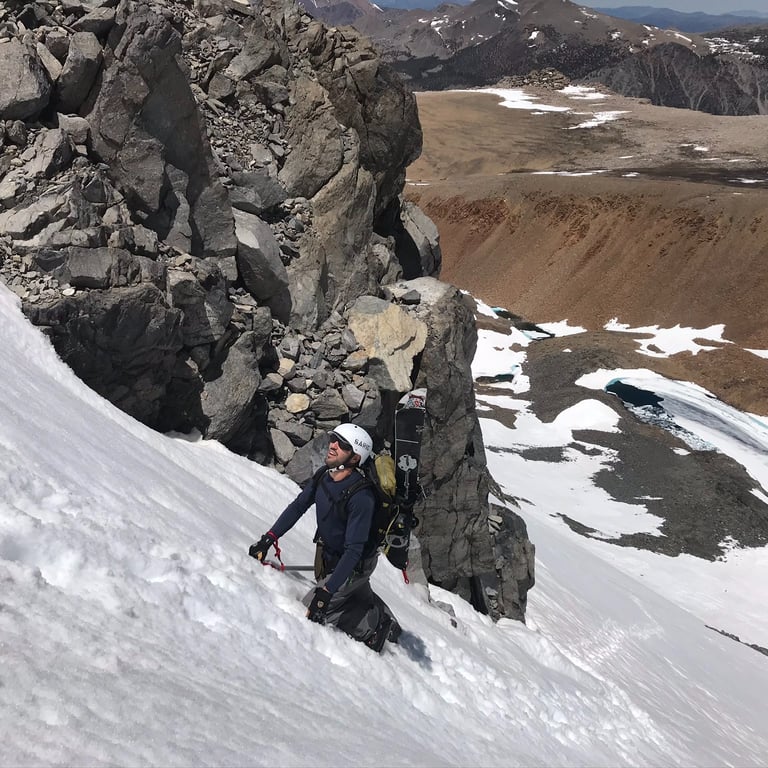
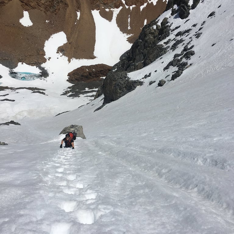
By 2PM I hit a crossroads and had to stop. It was getting too sketchy for me. The top of Solstice is very steep (around 45 degrees), riddled with rocks, and is capped by a giant cornice. Plus the snow was soft. To get to the top you have to safely navigate all of these features and it was just not worth it to continue. Both Ronen and Daniel were able to make it but I tapped out. The image below (not mine) shows the Solstice route. I do not remember exactly where I ended but I believe it was right around the final few rocks poking up at the top. We had radios to communicate with each other and I explained my situation. We agreed that I would transition and snowboard down the couloir. I had a blast on the way down with that soft snow and was able to just rip. While I was bummed that I could not make it to the top it was definitely the right call. The others made it to the top but did not feel comfortable dropping the cornice. They were forced to follow the ridgeline down instead so we stayed in radio contact and met back at the car.
June 10, 5:12PM: It was a slog back to the car. I was tired and boiling in the sun. My emergency bag of gummy bears were consumed in a few minutes. The others were only 20 minutes behind me after I made it to the car. I checked my phone and realized it was after 5PM. We were supposed to be back 3 or 4 hours ago. I checked my cell phone - no signal. I had a bad feeling about my girlfriend worrying about me. We loaded our gear in the car and turned it over...silence. Dead battery. No jumper cables and no emergency battery charger. We waved at the few cars passing by, but traffic was sparse on a Sunday evening. After about an hour or so we got lucky and were in motion again. There is no cell phone service on Tioga road until you get to the valley which is another hour or so. As soon as I had a bar of service I called home to my girlfriend. This is when I learned that she had made some phone calls out to the ranger station and local police services. Fortunately no one had actually started moving yet so the incident was cancelled. I felt awful, but she was relieved when I finally made it back home.
So, what were the lessons learned? I can think of three big ones for myself:
1. Start early. We grossly underestimated how long the lead in would take. While it is true that we lacked data on the current conditions, I think staring early would have given us enough time to problem solve and navigate through the terrain. Furthermore, you have a narrow time window this season where firm snow turns to good skiable corn usually by 11AM to noon. By 1 or 2PM it can become slushy and unsupportive. This increases the risk of wet loose avalanches and makes self arresting from a fall more difficult. Worst case scenario, you are back in town eating a burger earlier than anticipated.
2. Hazard assessment. While I am glad that I stopped and turned around, I should have done it sooner. Deep down inside I knew that I was not going to make it to the top. I was too slow and the features above me were too big for what I was feeling up to that day. By 1PM I could have sat on a rock, radioed the crew and just said "Hey, not feeling this - I will wait here for you guys." Ultimately, neither of my teammates felt safe dropping into the couloir. Was it even worth the risk?
3. Better communication. You can do all of the basic stuff (inform a friend of where you are going, what you are doing, expected return time, give them phone numbers, etc) but what do you do without cell coverage when things go wrong? I let a few days go by before bringing this topic up with my girlfriend. We agreed that a satellite based device would be extremely helpful. There are a handful of them out there, but I ended up getting the Garmin inReach Mini which provides emergency SOS outreach to SAR services but also 2 way texting. A simple "Hey, we are falling behind but totally ok - do not worry" text would have prevented a major scare and saved a lot of tax payer dollars if the rescue had actually initiated. I bring this device out with me for any long trek now, even the less technical ones. If you were really in an emergency situation you will be happy to have it in your back pocket. It fits in the palm of your hand - there really is no excuse to not bring it.
Fast forward 6 years later for Attempt 2 of Mount Dana